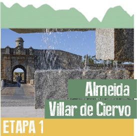
Almeida-Vale de Coelha-Frontier at the River Turones
Leave Almeida through the neighbourhood of Arrabalde de São Francisco. The landscape alternates between open terrain, with fields of cereal crops, and woodland areas of pines and other conifer species. The trial crosses several small riverbeds that only hold water during a few months a year, and then comes to a road. This asphalt road crosses the River Seco and enters Vale de Coelha.
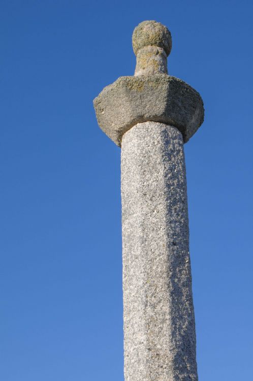
Vale de Coelha. This valley contains a pelourinho, a large stone pillory that symbolises the population’s power to impart justice. It Spain it is referred to as a rollo jurisdiccional. It is a simple design, topped by a little column that holds a ball. It probably dates from the 15th century.
Pillory in Vale de Coelha.
River Turones or Ribeira de Tourões. This river marks the frontier between Portugal and Spain, and it is crossed by means of a stone bridge. It is an example of an admittedly small river, but one that has enormous value for nature, as it is home to species of fish that have disappeared from other rivers that flow all the year round. One of the prevailing tree species is the narrow-leafed ash, together with several species of willow, and even an occasional alder. There is also a very wide diversity of birds, with highlights being the common nightingale and the golden oriole.
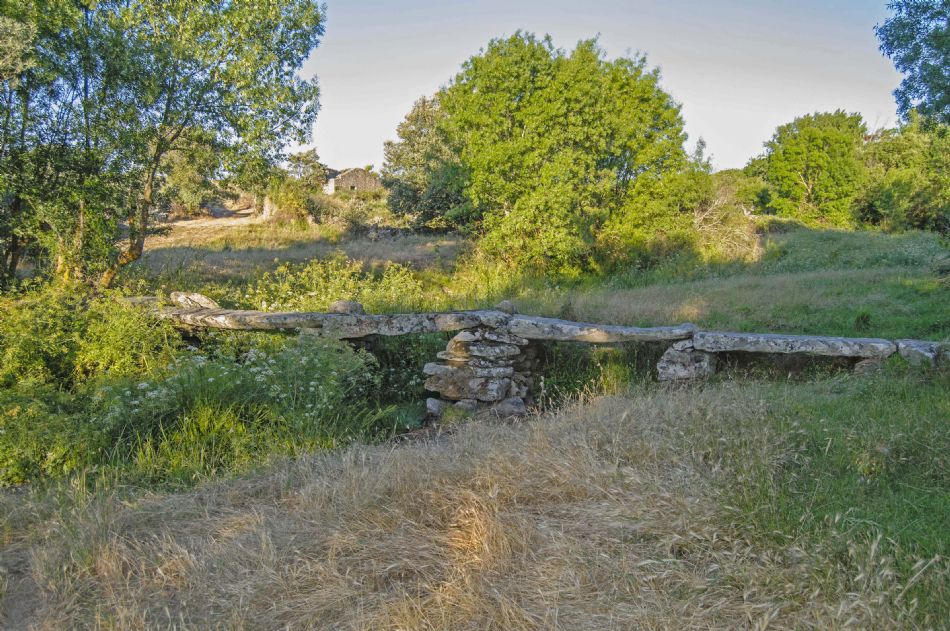 International bridge over the River Turones in Vale de Coelha.
Campo de Argañán. The name of this district is frequently mentioned in a document dated in 1376 as Campo de Alganán, and in 1414 as “Canpos de Algañán e Valdeazava”. Three hypotheses have been put forward to explain the sonorous name of Argañán: 1. From argaña ´a sort of pannier made of hemp or else ´crane´. 2. From a supposed compound ara-gañán. 3. From a Celtic-Roman property, again only a supposition, called Arganus or Arganius.
Aldea del Obispo. In the mid-19th century it had a customs house, where the main imports were cattle hides, common cane, green fruit, and silkworm cocoons; the principal exports, in turn, were wheat and rye, medium-quality wool and cloths from Béjar. The parish church was dedicated to Saint Sebastian, and dates from the 16th and 17th centuries. The chapel of the Humilladero [Calvary] is close to the entrance to the trail from Portugal, and constitutes part of an elongated plaza full of stone crosses. On the other side of the road there is a fountain with a large water trough also made of stone.
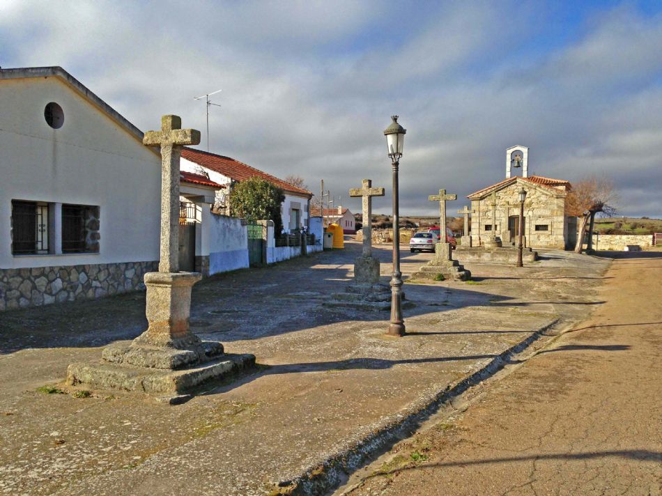 Calvary and Chapel of the Humilladero.
Royal Fortress of the Conception of Osuna (Aldea del Obispo). Its origin harks back to Portugal’s Declaration of Independence, emancipating the country from Spanish rule towards the end of 1640. Its construction began in 1663, on 8 December, the festivity of the Immaculate Conception, but one year later, when it had been fully built, it was razed by the Spanish themselves to stop it from being used by the Portuguese in a possible attack on Ciudad Rodrigo. Spain recognised Portugal’s independence in 1668. Between 1736 and 1762, following the study of several designs, work began on rebuilding the fortress, based on a project by Moreau. In 1762, shortly after the work had been completed, Spanish troops attacked Almeida. In 1810, Britain’s General Crauford ordered the partial demolition of the fortress to avoid it falling into the hands of the French army when it moved on Almeida. Today, its self-mutilated star shape can still be seen. It has recently been refurbished, and now houses a Posada Real hotel.
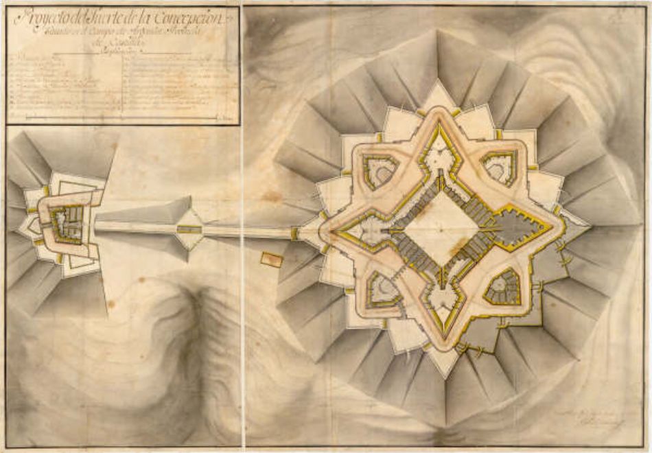 Layout of the Fortress of the Conception.
Museum of the Royal Fortress of the Conception. It is to be found on the main square in Aldea del Obispo, one of the sites on the Route of Frontier Fortifications. It is currently closed to the public, pending a possible re-opening sometime in the future. It provides a detailed history of this fortress, undoubtedly one of the finest examples of fortified architecture. It contains the building’s plans and other technical details, as well as a snapshot of the everyday life of the different garrison forces.
Los Boliches de La Torre (Aldea del Obispo). These remains stand beside the trail, in the direction of Villar de Ciervo, and they are apparently the ruins of a defensive tower, like a watchtower on a hill. Its origin is something of a mystery. It does not appear in the literature on the province’s fortifications, being therefore ripe for historical research. It does, however, appear in local legends, which on the one hand link it to the Fortress of the Conception —which does not seem particularly credible given the different types of materials and equipment used in their building— and on the other they refer to an alleged tunnel between this tower and the Fortress.
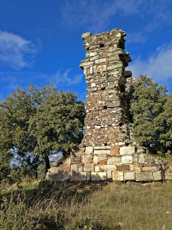
Los Boliches de la Torre.
La Garaballa and Las Arribes del Águeda. The Campo de Argañán is where the River Águeda begins to form its banks, known as Arribes, which are part of the Arribes del Duero National Park. These depressions can be seen from the trail, and a small stretch can be seen from the heights of La Garaballa, between Villar de Ciervo and Aldea del Obispo: the boxed-in valleys flanking the brook of Dos Casas. La Garaballa, Garagalla or Garbaya is a high, pleasant site with attractive landscapes of tended holm oak: an open window on biodiversity.
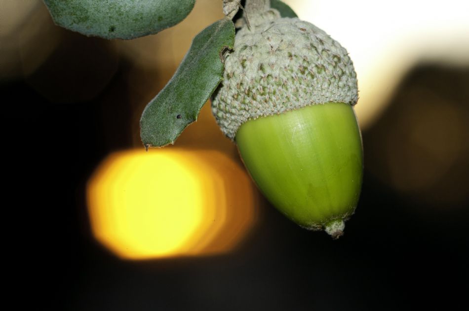 Holm oak acorns.
Villar de Ciervo. Shortly after entering Villar de Ciervo, beside the cemetery is the chapel of the Humilladero [Calvary], which houses a statue of the Nazarene.Both this place name and that of Villar de la Yegua might have archaeological meaning, referring either to the verracos –crude sculptures of pigs, wild boar or bulls- of the Vetton culture hitherto unknown in the area —except for the one in Gallegos de Argañán—, or else stelae such as the one found near Villar de la Yegua. The worship of deer was common among the Lusitanian peoples. In addition to the magnificent church ofSan Agustín, a substantial 16th century temple, there are several outstanding examples of popular architecture in granite. The Fuente Grande is popularly considered to be Roman. Beside the square presided over by the church and town hall, embedded in the frontage of a bar, there are two ancient reliefs, one is a coat-of-arms and the other depicts two busts facing each other with a chalice between them.
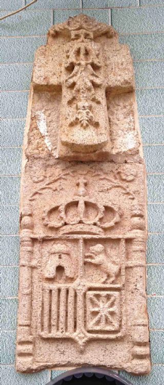 Ancient reliefs embed in a facade, Villar de Ciervo.