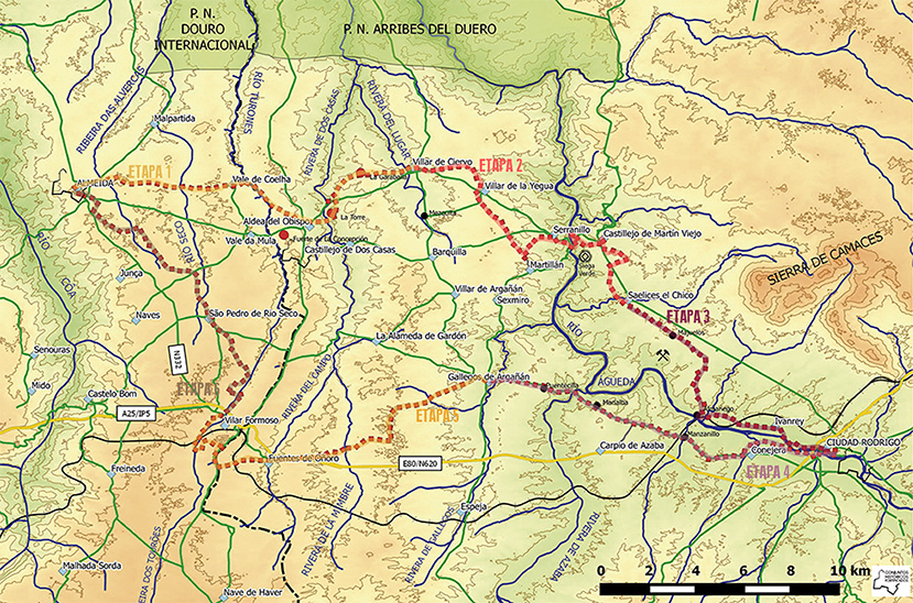
ESP   |   PORT   |   ENG    
THE ROUTE         |         MAP         |        CLIMATE AND SEASONS        |        TRAIL ADVICE        |        SOCIALISING
HERITAGE         |         POPULAR ARCHITECTURE         |        MTB CENTRE IN ALMEIDA
DOWNLOADS         |         OTHER LOCAL ROUTES         |        BIBLIOGRAPHY        |        LINKS


MAPA EN PDF

CARTOGRAFÍA
Portugal

España
• Servicio Geográfico del Ejército, Escala 1:50.000
Serie L, hojas nº 10-20 (Villar de Ciervo) y 10-21(Ciudad Rodrigo).
• Instituto Geográfico Nacional, Ministerio de Fomento, Escala 1:25.000
Hojas nº 500-III (Villar de Ciervo); 500-IV (Castillejo de Martín Viejo); 525-I (Fuentes de Oñoro); 525-II (Ciudad Rodrigo).
http://www.ign.es/ign/layoutIn/actividadesCartografia.do


Text and Photos: Juan Carlos Zamarreño Domínguez - Other images: files and publications held by the local councils of Almeida and Ciudad Rodrigo and by the Cross-border Consortium of Walled Cities [Consorcio Trasfronterizo de Ciudades Amuralladas].
Any full or partial reproduction of this site for commercial purposes is prohibited without the written permission of the authors and the Consortium.

LEGAL DISCLAIMER

Diseño web: www.dtinformatica.com