Stage 2
Villar de Ciervo-Villar de la Yegua-Serranillo-Siega Verde-Castillejo de Martín Viejo-Saelices el Chico
Villar de la Yegua. The place name Villar is common in the province of Salamanca, and stems from the Latin Villare. It is a sign of intense Roman colonisation and the continuity of the population in Visigoth times. On the outskirts, to the west of the town, there is a remarkable vaulted bridge, of ancient appearance, covered by a metal roof. In another part of the town there is a Roman stela, in the garden of a house, and it is clearly visible to visitors; it is 1.91 m tall and features a relief that appears to depict a deer. The parish church is dedicated to Saint John the Baptist and dates from the mid-16th century. The Chapel of the Humilladero is close to the trail, in the direction of Serranillo, and a short distance past it, marking an important crossroads, stands a slender granite cross —visibly leaning towards the north—on steps that have sunk in the middle under the weight of the cross.
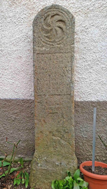
Roman stela in Villar de la Yegua.
Martillán. The trail passes close to this little hamlet but does not actually enter it. In medieval times it was called Martinllán, and its church was dedicated to Santiago – St. James.
Serranillo. This hamlet is part of the council of Villar de la Yegua and already existed as far back as 1376. Its name indicates that it was a medieval resettlement involving people from the mountain areas, the sierra, just like the pasturelands of Serranos, lying between Ciudad Rodrigo and Saelices el Chico.It has a simple 18th century church dedicated to San Blas – St. Blaise.
Depopulation during the War of the Spanish Succession. This war was especially hard on the district of Ciudad Rodrigo. Between 1704 and 1713 almost all the villages in Campo de Argañán —with the probable exception of Villar de Ciervo— were emptied of people by official decree. This is how it was described in 1935 by Mateo Hernández Vegas, a local historian in Ciudad Rodrigo:
“In 1704, shortly after war had been declared, the Spanish troops, acting under orders from the border commander and to avoid them falling into the hands of the enemy, burnt all the corn fields in Argañán and in many villages in Camaces and Robledo, forcing the entire population to leave their homes, churches and property and seek refuge with their relatives in this city, which led to so much despair, above all among farmers, who suddenly saw themselves stricken by the most abject poverty and abandon, whereby many threw themselves and their children into the flames so as not to suffer such mortal anguish.”
"The result of filling Ciudad Rodrigo with all these people from the district of Argañán and a large part of those from Robledo and Camaces was that in 1704 there was a horrendous epidemic such as had never before been witnessed in the history of Ciudad Rodrigo. Truly horrible is the scene described: Over 30,000 people died! Most of them were refugee farmers, which made it impossible to repopulate the fields, even many years after the war.”
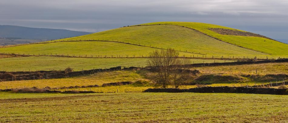
View from the GR 80 near Martillán.
Archaeological Site of Siega Verde (World Heritage Site). In the Upper Palaeolithic, or Late Stone Age, the people living in this area established a "sanctuary" of parietal, or cave, art, with wall paintings of wild horses, aurochs and other species, many of which became extinct towards the end of the Pleistocene. It was discovered only recently, in the late 20th century, and is considered to be one of the most important of its kind in the world, together with the Vale do Côa Archaeological Park. It has been declared a World Heritage Site, as an extension of this latter site in Portugal. The site, near the course of the River Águeda, has 94 listed panels with more than 500 figures. A visit to Siega Verde begins at the visitors centre, the Aula Arqueológica, and with a prior booking, we can enjoy a guided tour of some of the panels with pictures. We will be surprised by the art of those people who hunted and worshipped the huge animals that existed at that time.
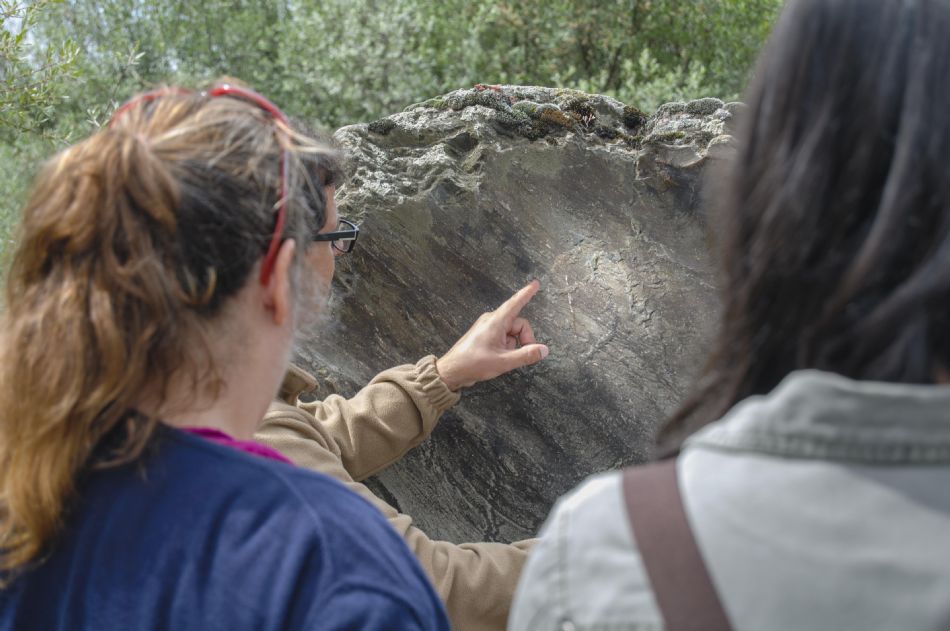
Guided visit to the rock-art Siega Verde.
The Bridge of Siega Verde or of the Union. This construction links the ancient lands or boroughs of Camaces and Argañán. It dates from 1925, as the original bridge —which even then was the second such project, as there had been no bidders in the tender for the first project drafted in 1896— was swept away by the massive flooding of the River Águeda in December 1909, only a month after it was first opened. The new bridge, which involved a third project, was built 1.2 km downstream from its predecessor. Curiously, the second project contained an annex providing for the addition of recesses to make it easier to blow up in the event of war.The district council in this area is called the Mancomunidad Puente La Unión.
Piélago Sordo. Downstream from the bridge there is a deep pool in the river that Casiano Sánchez Aires describe as follows: “perhaps the deepest part of the River Águeda, at a place called “Piélago Sordo”, which is undoubtedly home to some of the largest fish to be found anywhere in the river, because of the bottomless depths it contains. Although the level of the water has dropped considerably in times of severe drought, the bed has never been exposed over a stretch of more than one hundred metres, and it is easy to see how small the river’s gradient is, amounting to barely a few inches over half a league.”
Campo de Camaces. It is one of the fields or boroughs into which the area of Tierra de Ciudad Rodrigo was divided during Spain’s Ancien Régime, and it begins on the right bank of the River Águeda. Its name is an extension of the so-called Sierra de Camaces, where a river of the same name rises as a tributary of the Huebra.
Castillejo de Martín Viejo. The name of Castillejo refers to an ancient fortification, of which only the foundations now remain, on the banks of the stream of La Aldea. In the early 20th century, Casiano Sánchez Aires described a three-storey building.The church of San Juan – St. John dates from the 15th century, and underwent alterations in the 17th and 19th centuries.
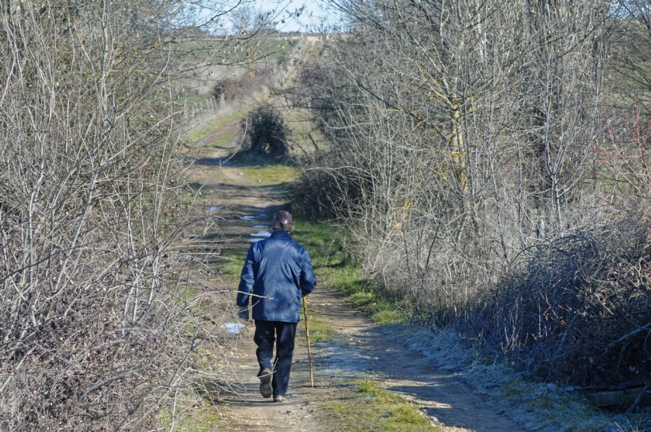
A walk through Castillejo de Martín Viejo.
Cristóbal de Castillejo. This was the hometown of the poet Cristóbal de Castillejo, who lived in the first half of the 16th century. He was born in 1490 in Ciudad Rodrigo, and died in Vienna in 1550, and he has made his own mark on the history of Spanish literature. Among other poems, he wrote some that are closely linked to the river’s waters:
"Ser merino / como dicen, de un molino / de sabios es aprobado, / pero no lo es ir contino / tras los reyes afanado / locamente."
"To be the carer / as they say, of a mill / is well looked upon by the wise / but not so to be continuously/ and madly solicitous towards kings"
Saelices el Chico. Its name may be attributed to Bishop San Félix of Porto, which means it was once Sanfelices, with Chico (Small) differentiating it from Sanfelices de los Gallegos. There is a popular story that tells of an alleged hero from the Peninsular War called El Chico, but it is clearly nothing more than a legend, as the name appears in medieval documents from 1413 in the Municipal Archive of Ciudad Rodrigo as Sant Felizes el Chico.The town’s medieval origin is an old Benedictine convent, by which it was governed. It has a bridge, claimed to be Roman—in actual fact, medieval— and a Roman villa, with mosaics and frescoes, declared a Spanish Cultural Heritage Site in 1997, and recently reburied, followings its excavation, so it cannot be visited. Some of the items found in this villa are on display in the Salamanca Museum. The village also preserves several examples of traditional architecture, including the Caño Viejo fountain, with a brickwork arrangement that is reminiscent of the Roman bridge. The parish church, dedicated to San Benito – St. Benedict, is of medieval origin and was rebuilt in 1743. Still standing, too, is the 18th century chapel of the Cristo de las Batallas – Christ of the Battles.
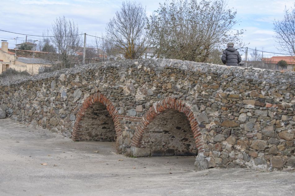
Ancient bridge of Saelices el Chico.
|