Stage 4
Ciudad Rodrigo-Gallegos de Argañán
Irrigation mosaics. Thanks to the irrigation system in place, there are market gardens and green pastures on the banks of the River Águeda. We are passing through a mosaic landscape interspersed with crops and pastures, buildings and hedges, copses and streams. This variety provides a setting for biodiversity, within an environment that becomes an oasis in summer. Among the numerous species that thrive here, there are such highlights as the cattle egret (Bubulcus ibis), with one of its handful of colonies in the province of Salamanca. This is a cosmopolitan species —it lives on several continents throughout the world— and takes its name from its habit of eating the insects that gather around cattle.
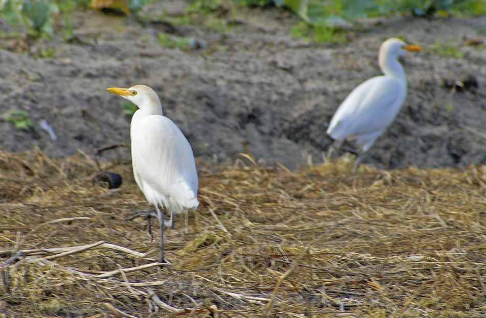
Cattle egret (Bubulcus ibis)
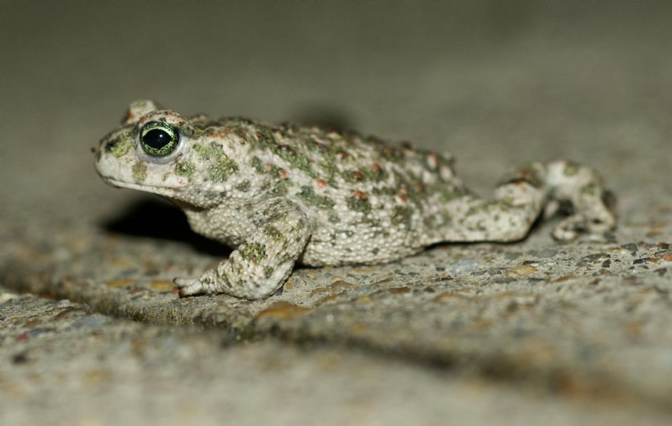
Iberian midwife toad (Alytes cisternasii)
Pastizales (Pasturelands) de Conejera-Manzanillo. Past the village of Conejera, the trail comes to the old road to Portugal, built at the beginning of the 20th century on an ancient track. It fell into disuse following the opening, in 1954, of the 620 main road.The trail passes through vast deforested pastureland. These pastures are poor in organic materials, but rich in plant species that are very rare in other regions, such as the adder's-tongue, southern adders-tongue or adders-tongue fern (Ophioglosum vulgatum) and the Ragged-Robin (Lychnis flos-cuculi). These landscapes are home to a raft of birds of prey and some grassland species, such as the great bustard (Otis tarda).
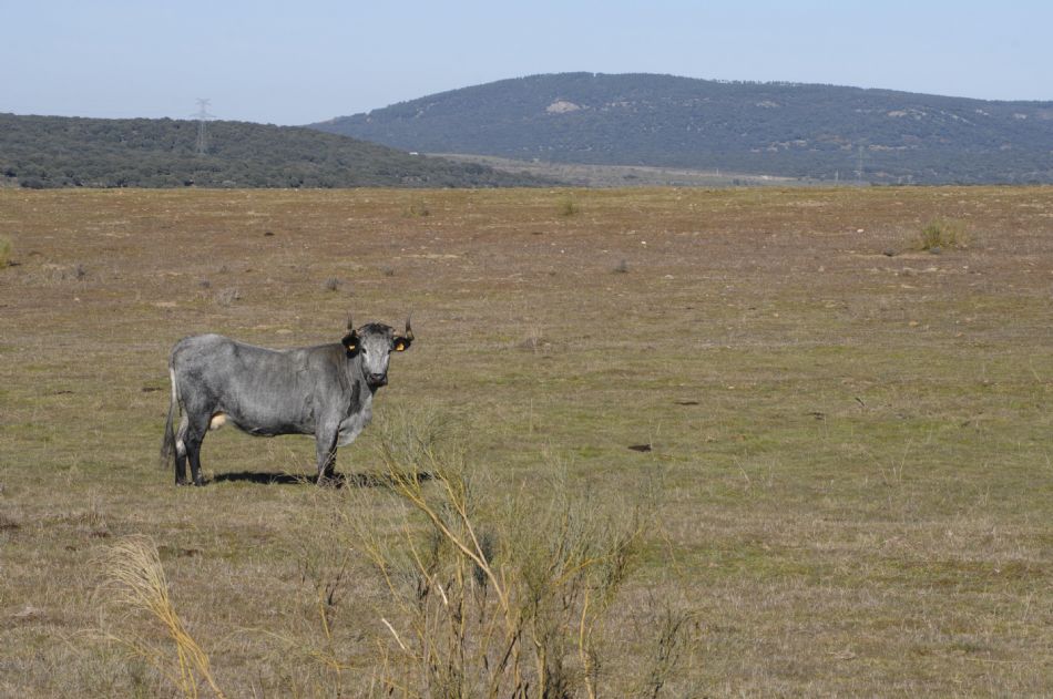
Grey-coloured Morucha cattle grazing in Manzanillo; in the background, the Sierra de Camaces.
SPA Campo de Argañán. Beyond the fertile lands of Ciudad Rodrigo lie a series of nature areas protected by the European Natura 2000 network. Our path leads through the Special Protection Area (SPA) of Campo de Argañán, covering an area of 173 km2. This corner of Spain, with sweeping landscapes of crops, pasturelands and rivers—among other features—, also has other Sites of Community Interest (SCIs) and SPAs that together form an area of 1,376 km2 of protected areas of community interest.
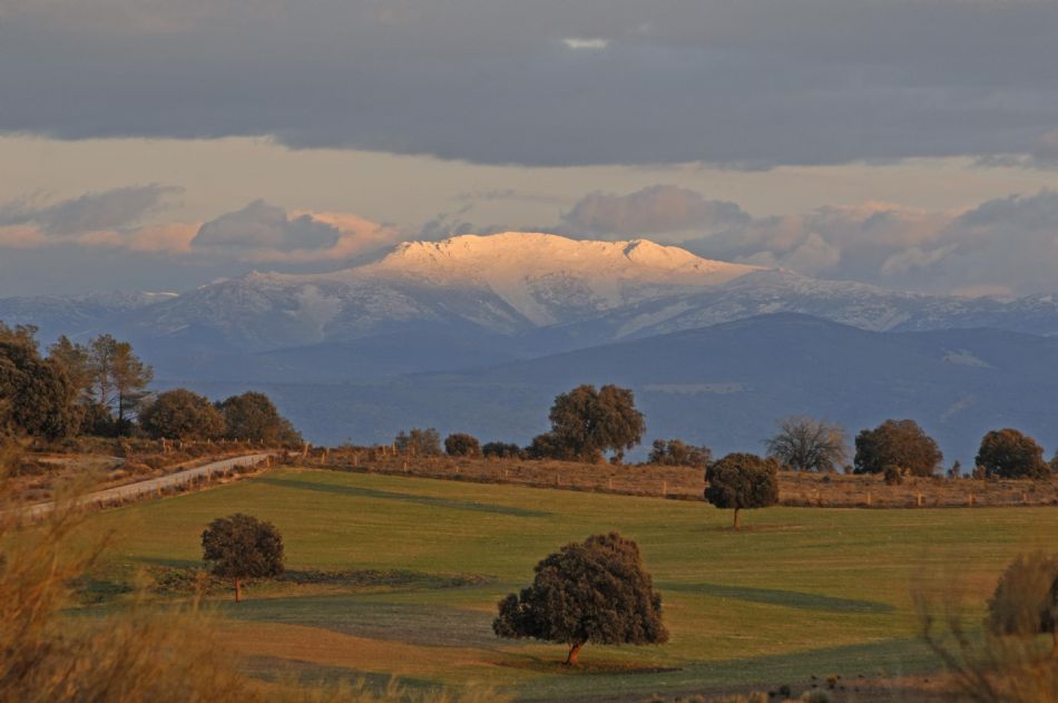
The GR 80 in the SPA Campo de Argañán with a snow-capped Sierra de Francia.
Manzanillo Bridge. Construction that already appears on old maps.
Marialba Bridge. Spanning the brook of Azaba, not far from where it flows into the Águeda, and between the old farmsteads of Marialba and La Puentecilla, this historical bridge was built merging architectural beauty with a delightful setting.It was built around the 17th century, although there are clearly architectural features from earlier times, such as the angular bridge piers with a layered finish.

Marialba Bridge, on the brook of Azaba.
The Spanish sparrow. This bird (Passer hispaniolensis), which is very similar to the house sparrow (Passer domesticus) is one of the more unique species we can espy relatively easily from the trail. As opposed to the house sparrow—which nests in buildings and enjoys human company, to the extent that when villages are left abandoned, it too takes it leave—, the Spanish sparrow nests in trees forming colonies (up to 30,000 nests) and does not seek human company. Nevertheless, there are certain cases of hybrid populations of Spanish and house sparrows. They often form colonies in the nests of stalks and other large birds. Whereas the house sparrow is a resident, the Spanish sparrow winters in Africa or in the south of the Iberian Peninsula, although there are also large winter gatherings in the province of Salamanca. It is a fairly common species in the basins of the rivers Tagus and Guadiana, but its colonies are few and far between in the northern part of the Iberian Peninsula. Its numbers are increasing in the province of Salamanca, and it has colonised other areas in the centre and west, spreading out from its traditional areas on the banks of the Águeda and the Turones. It builds its colonies between March and July.
Old Bridge of Gallegos de Argañán. A historical bridge, surrounded by a pleasant landscape of orchards, it welcomes us on the outskirts of this town as its crosses the brook of Gallegos. It dates from the 17th century, and the bridge itself has a harmonious design and is in a good state of repair.
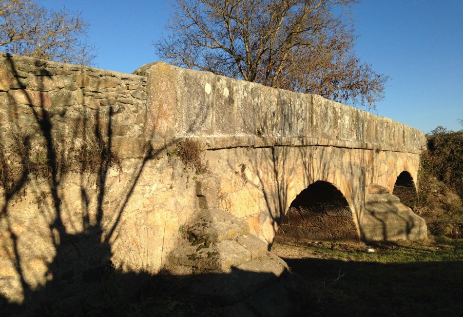
Old Bridge of Gallegos de Argañán, over the brook of Gallegos.
|