Stage 6
Vilar Formoso-São Pedro de Rio Seco-Almeida
El Riba-Côa Central. The middle stretches of the River Côa more or less involve the municipal area of Almeida. The local terrain consists largely of granite, which defines the landscape with its rounded shapes and constant defiance of the law of gravity. Toward the east, on the boundary with Salamanca, these shapes are tempered, and La Raya, the local name for the border, is no more than a simple line on the map, passing almost unnoticed on the land itself, except for the boundary markers that give it away and the intermittent course of the River Turones or Tourões. Toward the west, a stream, the Ribeira das Cabras, continues to etch away its course. Quartz dykes break up the rounded granite landscape.
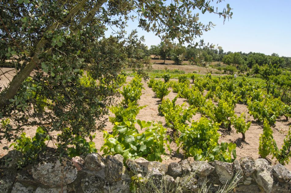
Vineyard and vegetable patches near Vilar Formoso.
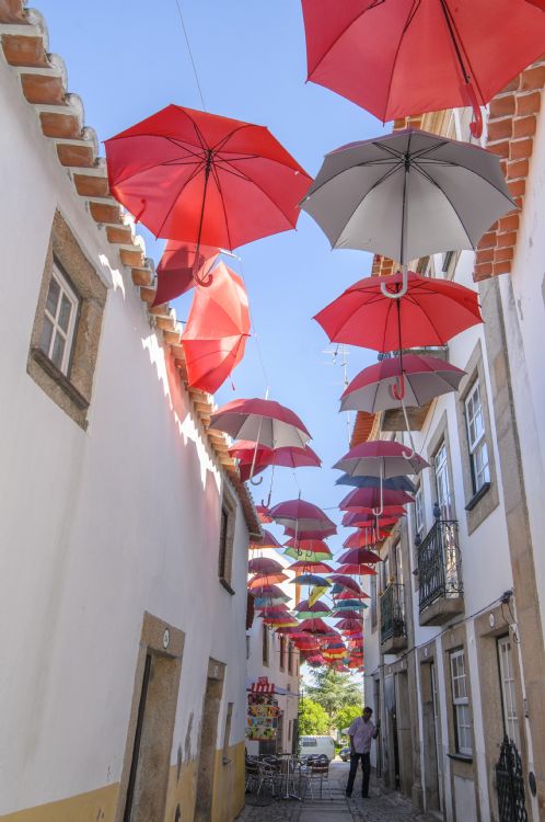
Vilar Formoso. Its name reflects its remote origin, as Vilar takes us back to the intense occupation of Roman times, which was followed by an equally numerous presence of the Visigoths. The name, meaning beautiful, also refers to its aesthetic attraction. The population has grown again in modern times, especially during the 20th century, and it is now the main road and rail gateway between Portugal and the rest of Europe. This trail will allow you to discover the less known part of Vilar Formoso, although you can also wander a few metres off the trail to discover such attractions as the artistic tiling on the railway station. The parish church has a well-preserved coffered ceiling in the Mudéjar style.
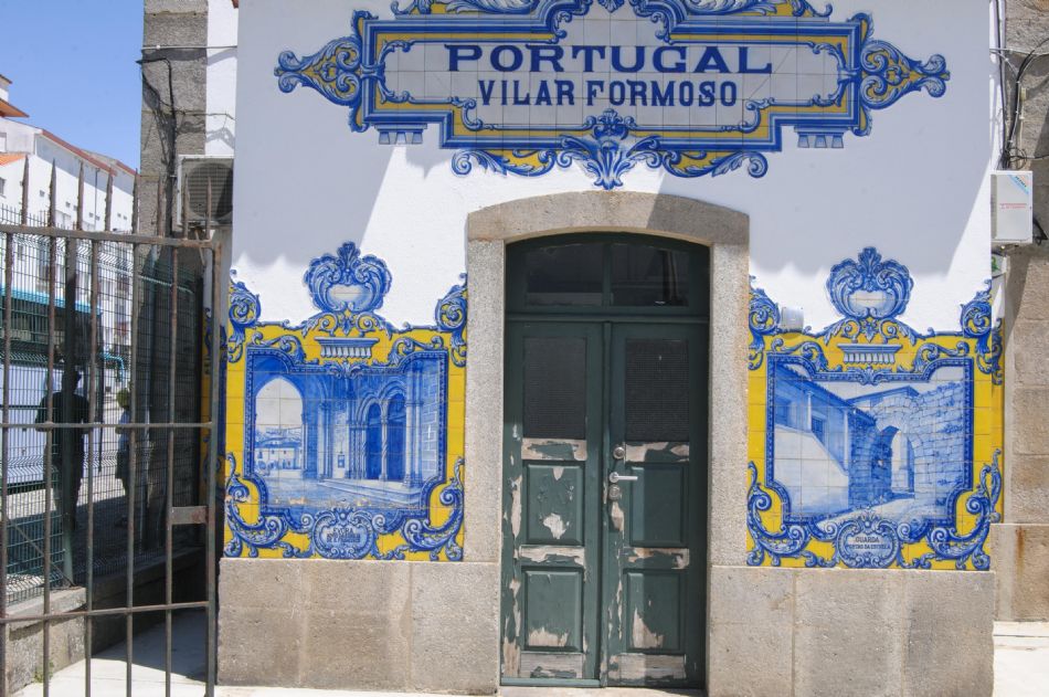
Detail of the railway station in Vilar Formoso.
River Turones. Although admittedly small, this river that flows across the broad plain of Vilar Formoso is an important one because of its biodiversity. It generally carries little water, and in summer it may be reduced to a series of successive pools with only a little water in each one. It is precisely for this reason, because they come and go, that these humble rivers have resisted the invasion of certain species of fish that in larger rivers —for example, the Águeda as it flows through Ciudad Rodrigo— have finished off many local native species, but which still survive here in the Turones. Other unique aquatic animals are turtles, with two species that are still to be found here: the Spanish pond turtle (Mauremys leprosa) and the European pond turtle (Emys orbicularis).
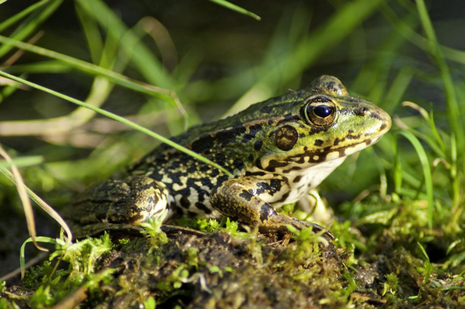
Perez's frog or Iberian water frog (Pelophylax perezi).
Ecotones beside people. The trail runs around the side of Vilar Formoso. These outskirts, where the urban and rural habitats meet, are transition areas that in the terminology of eco-sciences are referred to as ecotones. They are home to certain species that have to adapted to living with people, such as the house sparrow (Passer domesticus) and the barn swallow (Hirundo rustica), but the area is also visited by others that breed along the rivers, such as the white wagtail (Motacilla alba). The abandoning of crops, which becomes more noticeable as we leave human habitation further behind, is forcing many wild animals to settle nearer towns and villages.
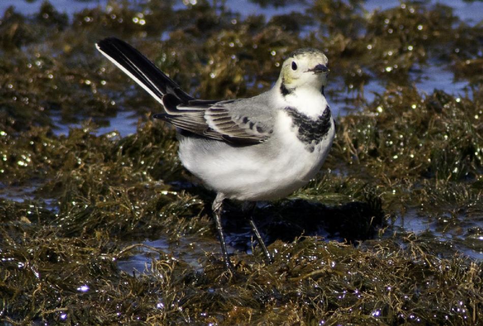
White wagtail (Motacilla alba).
The Iberian magpie: a local icon. The Iberian magpie (Cyanopica cooki), belonging to the crow family, is a common sight along almost the entire length of the trail, wherever there is tree cover. It is a very social and cooperative bird: the younger members of the family help to raise the chicks. Curiously, the Iberian magpie has a very unusual distribution. Within Europe, it is to be found solely on the Iberian Peninsula, while it has a close relative on the other side of the world, in Asia’s Far East. Hence the belief that it was brought to the peninsula by Portuguese navigators, but a more recent view is that this random distribution may be due to migrations that took place during glacial times.
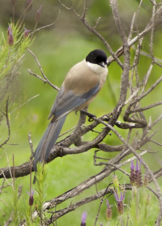
Iberian magpie (Cyanopica cooki).
São Pedro de Rio Seco. A walk through this village will reveal many of its cultural features. Highlights within the village itself are several tombs carved into the rock. This type of tomb is relatively common along this stretch of the frontier, La Raya, but its origin is still something of a mystery. The most widely accepted theory is that they were dug in the Late Middles Ages by the Goths. Before reaching the village on our way from Almeida we can see a dovecot. The trail also passes near an old Roman olive press.
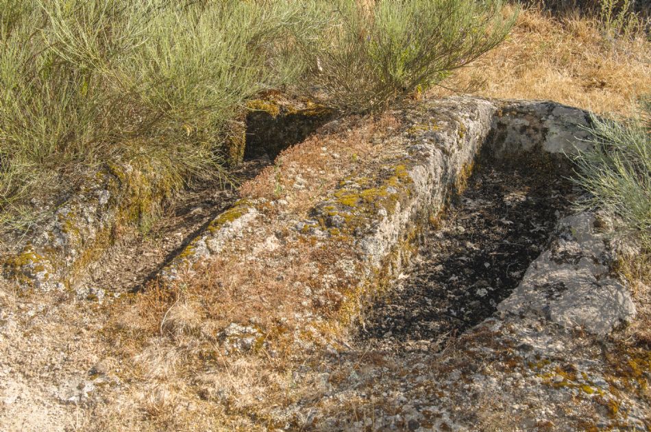
Late medieval tombs in São Pedro de Rio Seco.
Green tunnels. There is a succession of different landscapes between Almeida, São Pedro do Rio Seco, and Vilar Formoso, with one species of tree prevailing: the narrow-leafed ash (Fraxinus angustifolia). The trail wends its way along certain stretches through the privacy of the tunnels formed by these trees, although there are also shady avenues formed by Pyrenean oaks (Quercus pyrenaica). Both the ash and oak woodlands are significant habitats according to the European Union’s Habitats Directive.
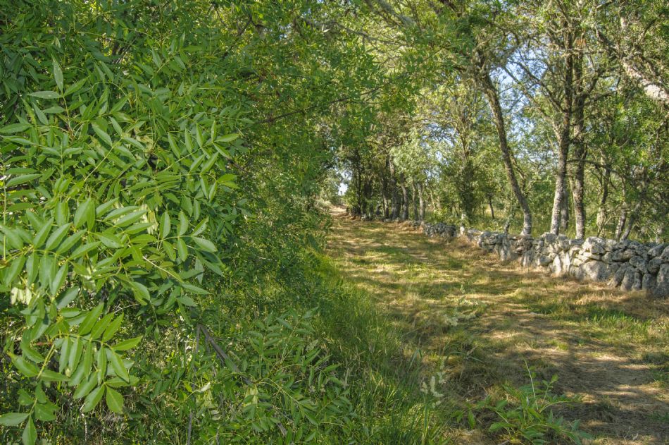
The trail passing through a tunnel of ash trees, near São Pedro de Rio Seco.
A jigsaw of biodiversity. This continuous alternation of pastures, crops and woodlands is extremely valuable for wild animals. This landscape provides a thriving habitat for all kinds of different species. All you need to do is notice anything that moves around you —and sometimes even what is hidden— to discover this biodiversity. Soaring overhead in this landscape you may see, among many other species, birds of prey such as the red kite (Milvus milvus), the black kite (Milvus migrans) and the common buzzard (Buteo buteo).
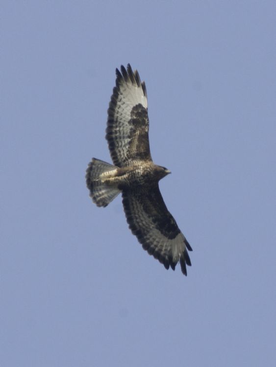
Common buzzard (Buteo buteo).
The time of transhumance. These rivers and their fluvial plains were an area of passage for transhumance - the seasonal movement of people with their livestock between fixed summer and winter pastures. This must have been the case thousands of year ago, in the Upper Palaeolithic, when tribes of hunters and nomads left a record of their knowledge and beliefs on the rocks at Bajo Côa.These lands of Almeida, therefore, are transition landscapes. Wherever the rivers have steep, high banks the climate is temperate, but the high plateaus swept by the winds and freezing temperatures are harsh, even inhospitable, places.
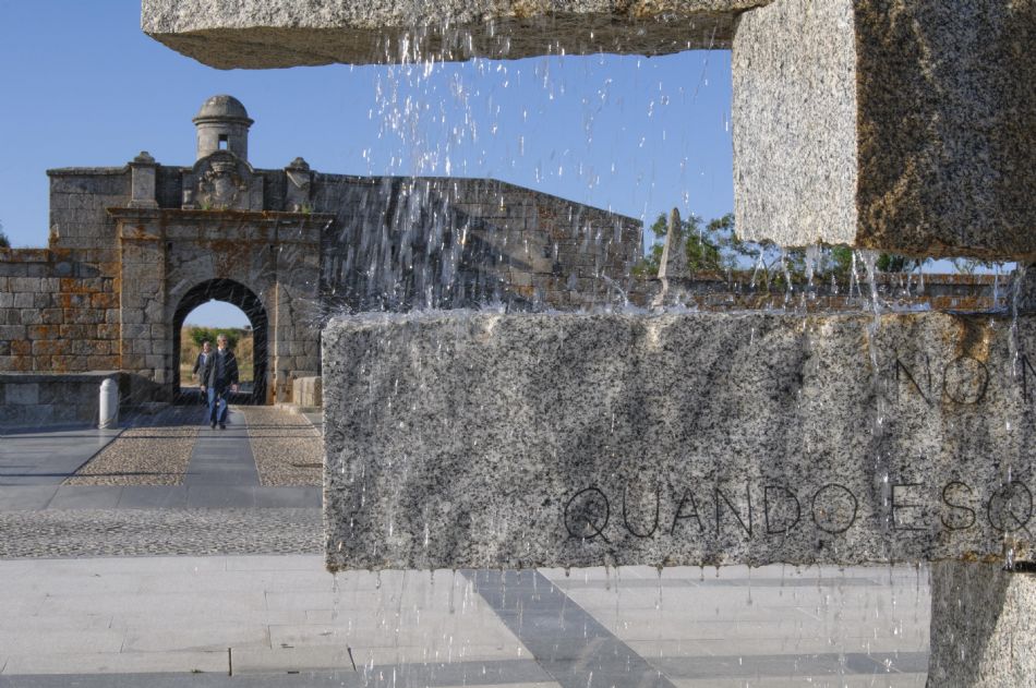
Fountain and Gun Ports of São Francisco, in Almeida.
Almeida overlooks the world. The city of Almeida has an Arab name meaning meseta or plateau, and it is in fact a hill that stands out above the fluvial plain. For many centuries now, its history has been linked to the territory of Ciudad Rodrigo, as back in the times when the Romans arrived this was the site of the fort of Cattacobriga, occupied by a tribe of Vettones, the same ethnic group that settled in the lands around Ciudad Rodrigo. Thousands of years earlier, both in the vicinity of Almeida and around Ciudad Rodrigo, human beings had left the tools of the Lower Palaeolithic, dating back more than 100,000 years.
Street in the historical town of Almeida.
Almeida: the twelve-pointed star. Designed as a stronghold to withstand attacks from the Spanish, this fortified site has filled the annals of sacrifice in the history of Portugal. It was, in fact, the country’s second largest fortress after Elvas, near Badajoz. From above, one can make out its layout as a twelve-pointed star, made up of bastions and ravelins, The rampart itself has a perimeter of 2.5 km, with a defensive ditch that in some points is a much as 60 m wide. The layout we see today dates from the end of the 18th century.
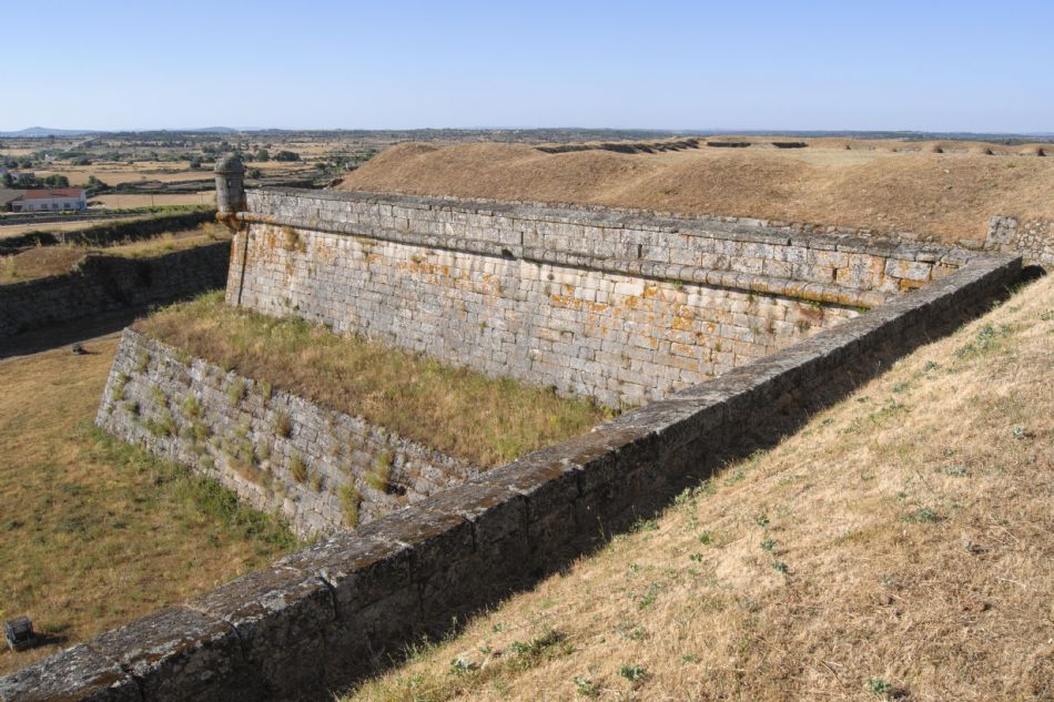
Ramparts and ditch in Almeida.
The wild ramparts. These fortifications provide numerous opportunities for a wide range of living creatures. Birds are the most visible animals, and many of them make the most of the gaps between stones to make their nests, whereas others seek shelter in trees or bushes, while there are even those that find protected places even on the ground. The Eurasian crag martin (Ptyonoprogne rupestris), the black redstart (Phoenicurus ochruros) and the common swift (Apus apus) are three examples of birds that have adapted to life among the fortified stars.
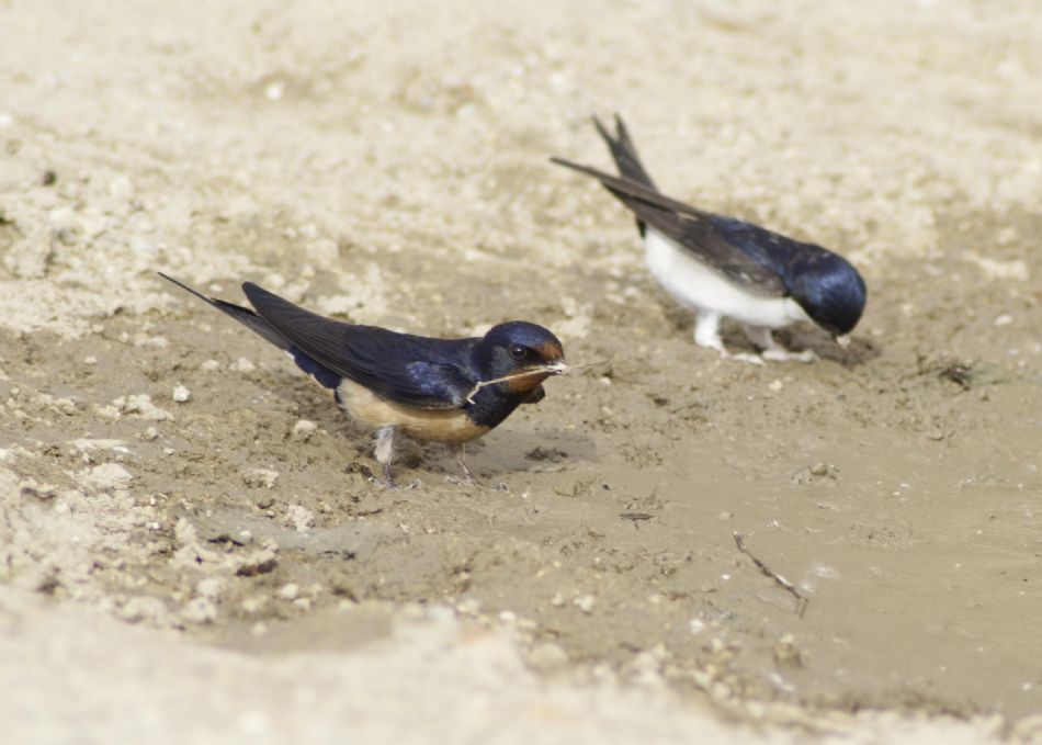
From left to right, the barn swallow (Hirundo rustica) and the Eurasian crag martin (Ptyonoprogne rupestris).
|